copyright for all images David Mcbride, 2011
For more information: http://davidmcbride.tumblr.com/


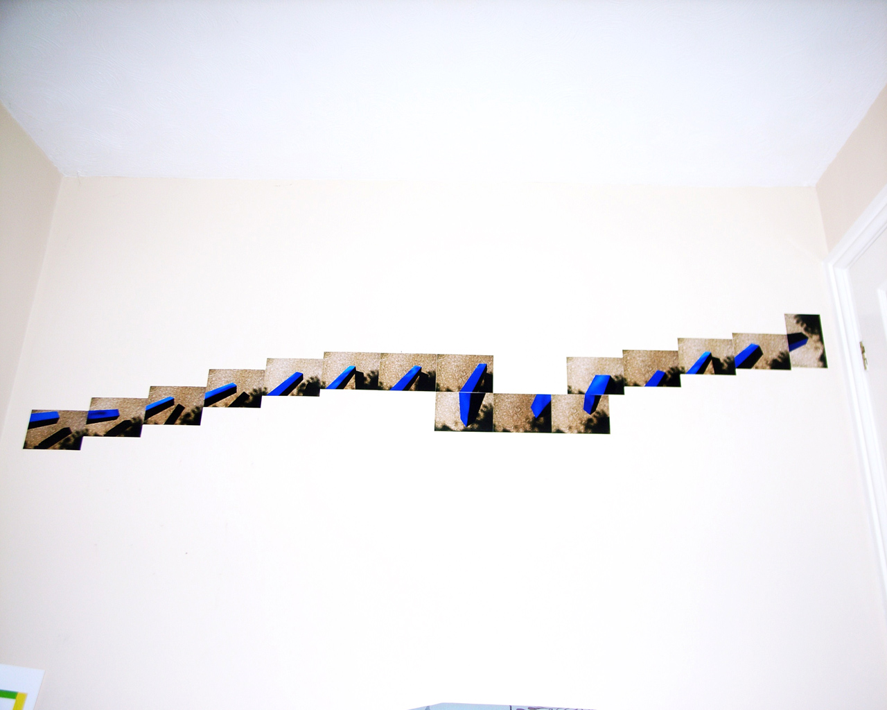
Further to my initial investigation into navigational systems as a photographic document and following on from my project - road markings - I had began to become very interested in the surface texture and make up of our roads and pathways. I began to record these spaces in more detail and by using the form that our natural light enables us to have, i was able to record these textures. Then I realised that I could evoke a more personal stance within these compositions by bringing more colour to the frame and produce an artificial third layer. It had something to do with my commitment to finding colour within the environment and highlighting this aspect, especially regarding our navigational systems. I then set out to find a meaningful and regular surface that I could work with that would possibly have some resonance historically to me. I settled on the paving directly in front of my house - walked over time and time again mainly by family and friends.
 The colour aspect of the frame was solved by placing painted strips of wood into this composed area until I was happy with the outcome. This artificial third layer enabled me to bring forward a more lyrical yet mental gestation to the picture. The more pictures I took the more I began to note that the project would only work as installations. These installations began to work as some kind of musical gesture. They had a lyrical form somehow. The early pictures were called orchestral manouvres in colour but I then moved on to adventures in colour. The project runs central to my main body of work and is on-going. It allows me to be a little bit more controlled and purposeful in my contemplation of form, surface and colour and the light that shapes it. - David McBride, 2011